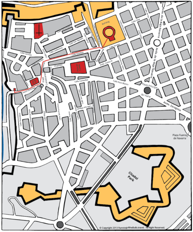
Running of the Bulls Route Map
The running of the bulls bull run route is mainly distributed among three streets: Santo Domingo, Mercaderes, and Estafeta. Each one of these streets has challenges on their own. If you’re thinking about joining the next “encierro,” make sure you understand where it’s best for you to begin your run. Here’s a short description of each one of the bull run sections and a map.
- Calle Santo Domingo is a sloping street that starts off the route. This bull run zone is extremely dangerous as bulls are just released from the corrals and are packed with energy.
- Plaza del Ayuntamiento (Town Hall Square) is a very short section of the route that also serves as the meeting point where the police filter the runners prior to the start.
- Calle Mercaderes is very well-known for the dangerous 90-degree turn, known as “La Curva” (Dead Man’s Curve), which funnels this section onto the next street.
- Calle Estafeta is the longest stretch of the run. This straight up street allows bulls to reach higher speeds. Runner’s can’t outrun the bulls and must clear the way in time.
- Telefonica and Callejon are the very last sections prior to entering Pamplona’s Plaza de Toros. Telefonica is a slight turn into the tight corridor entrance of the Plaza, known as “Callejon.” This zone is well known for its funnel-type entrance that drastically narrows down causing the runners to trip amongst each other and cause a disaster when the bulls reach that point.

